Close this alert
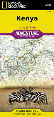
Kenya Map (National Geographic Adventure Map #3205)
Current price:
$14.95
Publication Date: June 30th, 2012
Publisher:
National Geographic Maps
ISBN:
9781566956185
Pages:
2
Usually Ships in 1 to 5 Days
Description
- Waterproof - Tear-Resistant - Travel Map
Explore the diverse and iconic landscapes and many unique recreation activities available in this exciting country with National Geographic's Kenya Adventure Map. Designed to meet the needs of adventure travelers with its detailed, accurate information, this map includes the location of cities and towns with a user-friendly index and a clearly marked road network complete with distances and designations for expressways and roads. Scenic routes, four-wheel-drive tracks, and other trails are shown for those seeking to explore more remote regions. National parks, World Heritage sites, forts, archeological sites, campsites, hot springs, beaches, diving areas, and more are clearly indicated so travelers can take advantage of Kenya's many natural and historical attractions.
The front side of the Kenya print map details the southern region of the country, from The Indian Ocean to the east, to the bordering country of Tanzania to the southwest. The reverse side of the map details the northern region, showing the bordering country of Ethiopia to the north, Somalia to the east, and Uganda to the west. Travel aids such as the locations of airports, airfields, railways, petrol stations, park entrances, and border crossings take the guesswork out of travel around the country.
Every Adventure Map is printed on durable synthetic paper, making them waterproof, tear-resistant and tough -- capable of withstanding the rigors of international travel.
Map Scale = 1:1,040,000Sheet Size = 37.75" x 25.5"Folded Size = 4.25" x 9.25"
Other Books in Series
Costa Rica Map (National Geographic Adventure Map #3100)
Folded
Scotland Map (National Geographic Adventure Map #3326)
Folded
Italy Map (National Geographic Adventure Map #3304)
Folded
Spain and Portugal Map (National Geographic Adventure Map #3307)
Folded
New Zealand Map (National Geographic Adventure Map #3500)
Folded
Germany Map (National Geographic Adventure Map #3312)
Folded
United States, Southwest Map (National Geographic Adventure Map #3121)
Folded
Mexico Map (National Geographic Adventure Map #3108)
Folded
Japan Map (National Geographic Adventure Map #3023)
Other
Iceland Map (National Geographic Adventure Map #3302)
Folded
Thailand Map (National Geographic Adventure Map #3006)
Folded
Ireland Map (National Geographic Adventure Map #3303)
Folded
Canada West Map (National Geographic Adventure Map #3113)
Folded
Canada East Map (National Geographic Adventure Map #3115)
Folded
South Africa Map (National Geographic Adventure Map #3204)
Folded
Alaska Map (National Geographic Adventure Map #3117)
Folded
Hawaii Map (National Geographic Adventure Map #3111)
Folded
Greece Map (National Geographic Adventure Map #3316)
Folded
Chile Map (National Geographic Adventure Map #3402)
Folded
United States, Pacific Northwest Map (National Geographic Adventure Map #3118)
Folded